Case studies
The following case studies offer a sample of innovative solutions for a wide range of clients by Spatial Intelligence

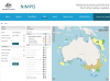
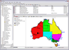
NIMPIS - Department of Agriculture
The National Introduced Marine Pest Information System (NIMPIS) is a central repository of marine pest information to assist Australian decision makers in the event of an incursion/outbreak. NIMPIS contains detailed information on the biology, ecology and distribution of marine pest species known to have been introduced to Australia, or considered to be a risk of future introduction. read more...

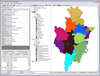
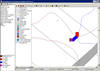
Telehealth Service Directory - NSW Ministry of Health
The Telehealth Service Directory allows you to find a Telehealth Service Location read more...
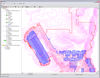
Development Assessment Register - Sydney Catchment Authority
The SCA required a system to manage the assessment of development applications within the Sydney water catchment and automate numerous development assessment and catchment information functions. Spatial Intelligence was commissioned to develop a spatially enabled application to meet these requirements. read more...
Waste Collection and Tracking System
Ryde City Council and WSN required a real time waste collection and tracking system. In conjunction with WeighMate and Rojan, Spatial Intelligence developed a system that tracks garbage collection as it is being collected by the garbage truck and a real time monitoring and reporting system. read more...

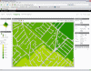
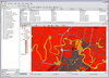
Fire Trail Mapping - Rural Fire Service
The Rural Fire Service required cartographic quality maps of fire trails to be used by its outdoor staff and volunteers. read more...
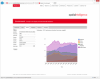
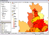
Data visualisation - Spatial Intelligence
We undertook a study on how best to visualise environmental data with maps, charts and tables. read more...
DocuMap - Wagga Wagga City Council
Wagga Wagga City Council required an electronic plan management system. They were seeking a system that was geographically based that would link to their GIS system. DocuMap was chosen and implemented to meet the requirements. read more...
Development Assessment Module - Sydney Catchment Authority
The SCA required a system to assess the potential risk of individual on-site effluent management systems. Spatial Intelligence was commissioned to develop a spatially enabled application to meet these requirements. read more...
Compliance Support System - Sydney Catchment Authority
The SCA required an integrated information system to support staff and management in the performance of the SCA's compliance program. Spatial Intelligence was commissioned to develop a spatially enabled application to meet these requirements. read more...
DocuMap - Newmont Exploration
Newmont Australia had a large amount of valuable data that related to project generation and site specific tenement data. They realised at an early stage that this data would be best accessed via a spatially enabled application. DocuMap was chosen for the task. read more...
DocuMap - Mine Subsidence Board
The MSB realised that it needed to replace its existing Information Management System (IMS) with a more modern, reliable and efficient system. Spatial Intelligence is part of a consortium that won a tender to supply and implement the new IMS. read more...