Wagga Wagga City Council:
DocuMap
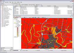
DocuMap with map and document list
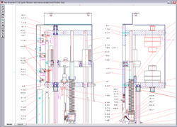
Viewing a CAD document with DocuMap
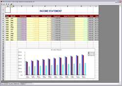
Viewing an Excel document with DocuMap
project name
Wagga Wagga City Council - DocuMap
the aim
Wagga Wagga City Council (WWSC) required an electronic plan management system. They were seeking a system that was geographically based that would link to their GIS system. DocuMap was chosen and implemented to meet the requirements.
the solution
WWSC had a large number of hard copy and electronic CAD documents that needed to be managed and accessed. The hard copy CAD documents were scanned using a large format scanner. These plus the electronic documents were then registered in DocuMap. This meant they were now in a DMS and linked to their GIS. Users employ the logical and simple interface of DocuMaps' GIS to find the required document for a road segment, property, sewer or other asset item.Once all the nominated CAD documents had been added other documents that greatly benefit from a GIS interface have also been added. These include:
- Sewer diagrams
- Deposited Plans
- PM and SSM diagrams
- etc
Wagga Wagga's DocuMap is based on the following components:
- Microsoft Windows
- Microsoft SQL Server
- ESRI GIS
- ESRI ArcGIS
Tags
more details
For more details please use our 'Contact us' page or email us at info@spatialintelligence.com.au